Exploring Swiss Heritage in 3D
Last Friday, Switzerland celebrated its National Day – a time traditionally marked by a strong sense of community.
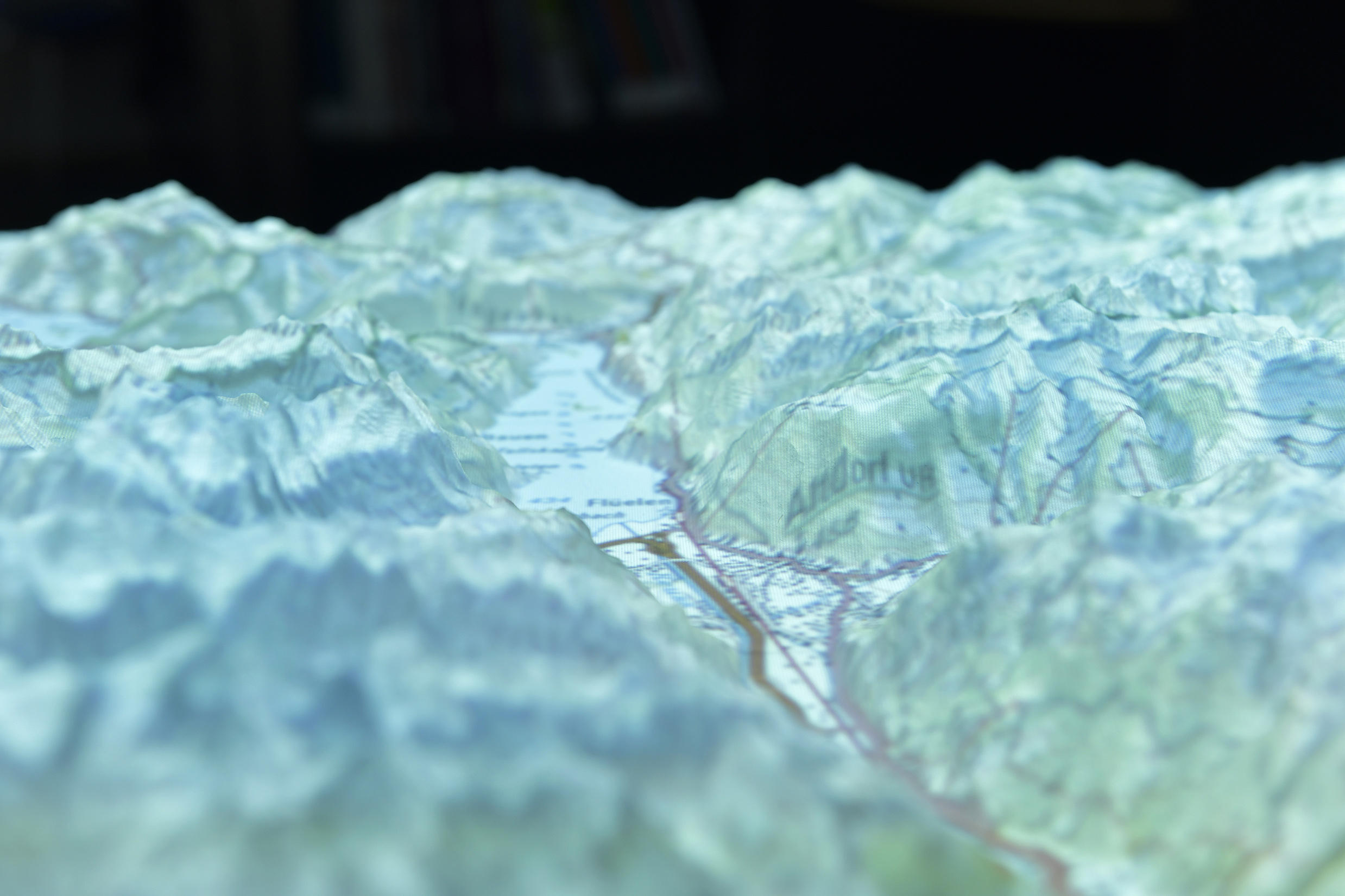
In the Federal Charter of 1291, the founding cantons of Uri, Schwyz, and Nidwalden pledged mutual support against injustice. This historic agreement laid the foundation for Switzerland’s values of solidarity and cooperation. The visual featured here shows a section of the canton of Uri, with a clear view of its capital, Altdorf – a symbolic place in the heart of Switzerland’s origins.
To mark the occasion, the Visualization and MultiMedia Lab, led by Prof. Dr. Renato Pajarola, shared insights from its ongoing 3D cartography research. The lab develops advanced techniques for interactive visualization of large-scale digital elevation models, which are essential in fields such as geographic information systems (GIS), virtual environments, and VR applications.
One example is a novel algorithm capable of processing large datasets – including polygons with millions of segments – in real time. Compared to previous methods, it offers higher performance and lower memory usage, making it ideal for rendering complex geographic data efficiently.
Another innovation is a novel clutter-free bubble map visualization, which enables an intuitive exploration and quantification of weather reports.
Curious to see more? Follow us on Instagram for research highlights and behind-the-scenes insights: https://www.instagram.com/uzh_ifi